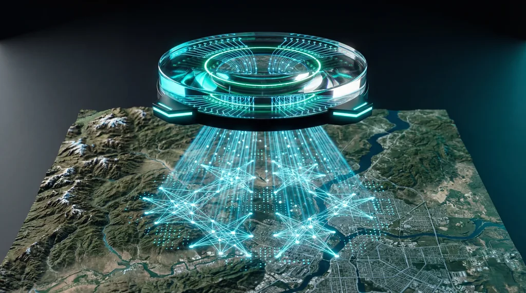

TerraScope represents a transformative shift in geospatial artificial intelligence, introducing a unified model capable of pixel-grounded visual reasoning for Earth observation. While traditional satellite analysis has long relied on simple image classification, the complexity of modern environmental monitoring requires models that can reason about spatial data with high precision. Developed by researchers including Bin Ren, Nicu Sebe, and Xiao Xiang Zhu, TerraScope addresses the critical "grounding" gap in current Vision-Language Models (VLMs), allowing the AI to link complex analytical conclusions to specific, verifiable pixel-level visual evidence.
The Evolution of Earth Observation AI
The field of Earth Observation (EO) is currently transitioning from basic pattern recognition to sophisticated, multi-layered spatial reasoning. Traditional Vision-Language Models (VLMs) often struggle with the granular demands of satellite imagery, frequently providing "hallucinated" or unverified textual descriptions that lack a direct connection to the underlying pixel data. This disconnect limits the utility of AI in high-stakes fields like urban planning or climate science, where visual proof of a model's logic is just as important as the final classification result.
TerraScope was designed to solve this lack of interpretability by embedding pixel-level masks directly into its reasoning chains. By leveraging Geospatial AI techniques, the model does not just state that an area has been deforested; it generates a precise mask over the affected pixels to justify its conclusion. This methodological leap ensures that the AI’s logic is physically grounded in the raw data, providing a level of transparency that previous models could not achieve.
What is the difference between optical and SAR imagery in earth observation?
Optical satellite imagery captures reflected sunlight to produce human-readable, multi-spectral images, while Synthetic Aperture Radar (SAR) uses active microwave pulses to map the Earth's surface. Optical data is ideal for color-based analysis like vegetation health, but SAR imagery is essential for monitoring through cloud cover, smoke, or darkness, as it detects physical texture and moisture rather than light reflectance.
The synergy between these two modalities is a cornerstone of the TerraScope architecture. In many regions of the world, persistent cloud cover renders optical sensors useless for weeks at a time. By integrating Synthetic Aperture Radar (SAR), TerraScope ensures continuous monitoring capabilities. The model treats these distinct data streams not as separate inputs, but as complementary layers of a single geographical truth, allowing for a more robust understanding of the Earth's surface regardless of atmospheric conditions.
Can TerraScope handle multi-modal satellite data?
Yes, TerraScope features a modality-flexible reasoning engine that can process single-modality inputs or adaptively fuse optical and SAR data when both are available. This enables the model to maintain high performance in clear conditions using optical imagery while seamlessly switching to or incorporating radar data to "see" through obstacles like clouds or nighttime shadows.
The research team implemented an adaptive fusion mechanism that allows the model to weigh the importance of different sensors based on data quality. For instance, if an optical image is obscured by 80% cloud cover, TerraScope automatically prioritizes the SAR signal to maintain reasoning accuracy. This flexibility is vital for global-scale applications where data availability varies significantly by region and weather patterns, ensuring that the Vision-Language Models (VLMs) remain reliable in all scenarios.
Multi-Temporal Reasoning and Change Analysis
The ability to track environmental shifts over time is facilitated by TerraScope’s multi-temporal reasoning framework. Unlike static models that analyze a single snapshot, TerraScope integrates temporal sequences to perform complex change analysis. This allows the model to identify not just what is present on the ground, but how it has evolved over months or years, which is critical for monitoring urban sprawl, glacial retreat, or agricultural cycles.
By comparing pixel-level data across different timestamps, TerraScope can distinguish between seasonal variations and permanent land-use changes. The model’s reasoning chains are trained to recognize the "before and after" states of a landscape, providing a narrative of change that is backed by pixel-grounded evidence. This temporal awareness transforms the model from a simple observation tool into a dynamic historical analyst of the Earth's surface.
Terra-CoT and the Benchmark for Authenticity
To train this advanced model, the researchers curated Terra-CoT, a massive dataset containing 1 million samples with pixel-level masks embedded in reasoning chains. This dataset uses a "Chain of Thought" (CoT) approach, teaching the AI to follow a step-by-step logical path from data ingestion to final conclusion. This ensures that the model’s outputs are not just lucky guesses, but the result of a structured analytical process.
- 1 Million Samples: A diverse library of satellite imagery from multiple global sources.
- Pixel-Level Masks: Every reasoning step is linked to specific visual segments for verification.
- TerraScope-Bench: A new performance standard evaluating six distinct geospatial sub-tasks.
- Interpretability: The dataset prioritizes "why" a model reached a conclusion, not just the "what."
Furthermore, the introduction of TerraScope-Bench provides the scientific community with a rigorous framework to test future Vision-Language Models (VLMs). This benchmark measures both the accuracy of the textual answer and the quality of the generated pixel mask. By holding models accountable to the physical data they analyze, Bin Ren and the team have set a new bar for authenticity in Geospatial AI research.
What are the applications of TerraScope in disaster response?
TerraScope enhances disaster response by providing rapid, explainable assessments of damage through its ability to fuse SAR data with multi-temporal analysis. During floods or hurricanes where cloud cover blocks traditional satellites, the model uses radar to map inundated areas and identifies structural damage by comparing current imagery against historical pixel-level baselines.
In the high-pressure environment of emergency management, explainable AI is a requirement, not a luxury. TerraScope provides first responders with more than just a damage report; it provides a highlighted map of the exact pixels representing flooded roads or collapsed buildings. This pixel-grounded reasoning allows for better resource allocation and higher confidence in AI-generated insights, potentially saving lives by accelerating the identification of accessible routes and trapped populations.
Real-World Applications for Digital Twins
The long-term goal for models like TerraScope is the creation of highly accurate Earth Digital Twins. These are virtual replicas of our planet that update in real-time, allowing scientists to simulate climate scenarios or urban developments. Because TerraScope understands the relationship between pixels and physical entities, it can provide the high-fidelity data streams necessary to keep these digital models synchronized with reality.
As Vision-Language Models (VLMs) continue to evolve, the integration of pixel-grounded visual reasoning will become the standard for all Earth observation tasks. The work of Nicu Sebe and his colleagues demonstrates that the future of satellite intelligence lies in the ability to explain the world through both language and precise visual evidence. This synergy promises a new era of automated, transparent, and highly accurate geospatial intelligence that will be foundational for the next generation of environmental stewardship.

Comments
No comments yet. Be the first!