
Artificial intelligence (AI) is currently playing a transformative role in the Strait of Hormuz blockade by processing massive datasets from satellite imagery and remote sensing to identify "dark vessels" that have deactivated their mandatory tracking systems. By fusing AI-driven radar analysis with sensor correlation, naval forces and commercial analysts can now detect maritime activity that remains invisible to traditional tracking, allowing for the monitoring of contested waters and the adjustment of insurance risk models in real-time. This technological shift represents a move toward transparent, commercially available intelligence in one of the world's most volatile maritime bottlenecks.
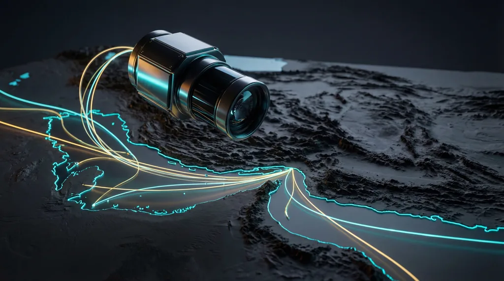
The Strait of Hormuz remains the world's most important energy chokepoint, with nearly a fifth of global oil consumption passing through its narrow waters daily. Historically, monitoring this region was the exclusive domain of classified military surveillance; however, a recent surge in geopolitical tensions has driven a massive shift toward commercial geospatial intelligence (GEOINT). As traditional diplomatic channels struggle, analysts are increasingly relying on high-frequency satellite constellations and advanced algorithms to provide a factual baseline for international trade and security policy.
The Mechanics of Modern Geospatial Intelligence
Modern GEOINT relies on the fusion of Synthetic Aperture Radar (SAR), high-resolution optical imagery, and Automated Identification System (AIS) data to create a persistent surveillance web over maritime corridors. While optical satellites provide visual confirmation, SAR technology is critical because it can "see" through clouds, smoke, and darkness, ensuring 24/7 monitoring of the Strait of Hormuz regardless of weather conditions. This multi-layered approach allows analysts to cross-reference reported positions with physical reality, exposing discrepancies in vessel reporting.
Commercial providers are rapidly filling the information gap left by government entities that may withhold data for strategic reasons. By using these technologies, analysts can achieve the following:
- Continuous Monitoring: Utilizing small-satellite constellations to achieve high revisit rates, sometimes capturing images of the same location multiple times per day.
- All-Weather Sensing: Leveraging SAR imagery to penetrate the frequent haze and dust storms common in the Middle East.
- Data Transparency: Providing unclassified reports that can be shared among international stakeholders, insurers, and shipping companies to inform collective decision-making.
What are the risks of GPS spoofing in the Strait of Hormuz?
GPS spoofing in the Strait of Hormuz creates severe navigational hazards by causing vessels to appear hundreds of kilometers away from their actual locations or by generating "ghost" tracks on digital maps. These sophisticated electronic warfare tactics interfere with Automated Identification Systems (AIS), leading to increased transit times, higher pilot requirements, and the potential for accidental entry into contested territorial waters. Such interference often triggers insurance exclusions, significantly raising the cost of maritime operations.
According to recent reports, electronic warfare in the region has evolved from simple signal jamming to complex spoofing patterns, including circular distortions and zig-zag displacements. Analysts have detected over 30 distinct jamming clusters across regional countries, which target both commercial shipping and unmanned aerial vehicles (UAVs). To counter this, geospatial experts use satellite imagery to validate a ship’s true physical position, providing a "truth source" that overrides manipulated electronic signals. This verification is essential for maintaining the safety of the crew and cargo in high-risk zones where a single navigational error could lead to international escalation.
Why is demand for satellite imagery surging due to the Hormuz crisis?
Demand for satellite imagery is surging because traditional tracking methods, such as AIS, often show a complete cessation of traffic while remote sensing reveals that "dark vessels" continue to operate. As commercial shipping companies halt official transits, multi-source intelligence becomes the only way to monitor vessel backlogs, unauthorized ship-to-ship transfers, and the true extent of maritime activity within the crisis zone. This transparency is vital for global markets to assess the actual impact on energy supplies.
The reliance on commercial geospatial intelligence has democratized access to high-level strategic data. In previous decades, only superpowers possessed the means to track "dark" shipping; today, private analysts at institutions like SpaceNews and various maritime security firms can publish real-time insights into illicit maneuvers. This shift has significant implications for global trade, as it allows for:
- Verified Risk Assessment: Helping insurers set premiums based on physical evidence of threat levels rather than speculation.
- Supply Chain Predictability: Enabling logistics companies to reroute vessels based on observed congestion at the Strait of Hormuz.
- Policy Influence: Providing open-source reporting (OSINT) that can be used by international bodies to hold state actors accountable for maritime interference.
Artificial Intelligence and Predictive Data Fusion
Artificial Intelligence serves as the engine of modern maritime surveillance, processing vast quantities of orbital data at speeds impossible for human analysts to match. By employing machine learning algorithms, systems can automatically flag anomalies in vessel behavior, such as a ship suddenly changing speed or deviating from established shipping lanes. These AI models are trained to recognize the unique "signatures" of different vessel types, allowing for the automated detection of unauthorized maneuvers or suspicious proximity between ships.
Predictive modeling is also becoming a cornerstone of maritime security. By analyzing historical traffic patterns alongside current threat feeds, AI can forecast potential "hotspots" for interference or seizure. This proactive approach allows shipping companies to implement security measures before a vessel enters a high-risk area. Furthermore, automated detection of ship-to-ship transfers—often used to bypass sanctions—enables regulatory bodies to monitor compliance with international law more effectively than ever before.
Impact on Maritime Security and Global Trade
The integration of advanced GEOINT into the maritime sector is fundamentally changing the economics of shipping through volatile regions by reducing insurance premiums through verified data. When shipping companies can prove their vessels are following safe corridors or that reported threats are localized, they can negotiate more favorable terms with underwriters. This transparency reduces the "risk premium" often associated with the Strait of Hormuz, ultimately stabilizing costs for consumers downstream.
Moreover, the democratization of intelligence means that even smaller shipping lines have access to the same quality of data once reserved for national navies. This level playing field enhances the overall safety of the maritime ecosystem. Open-source reporting has also become a tool for diplomacy; when satellite imagery provides undeniable proof of illicit activity, it creates a "digital deterrent" that can discourage aggressive behavior by state and non-state actors alike who wish to avoid international condemnation.
The Future of Orbital Surveillance
The future of maritime monitoring lies in the proliferation of small-satellite constellations that provide near-constant revisit rates and the deployment of edge computing directly in orbit. By processing data on the satellite itself, providers can transmit instant alerts to ground stations the moment a "dark vessel" is detected, rather than waiting for the full data set to be downloaded and analyzed. This move toward real-time orbital intelligence will further shrink the window in which illicit activities can occur undetected.
However, this "always-on" surveillance brings about complex ethical considerations regarding the balance between privacy and security in international waters. As the Strait of Hormuz crisis continues to drive innovation, the maritime industry must navigate the legal frameworks governing data ownership and the use of AI in sovereign territory. Despite these challenges, the trend is clear: the invisible eye of satellite intelligence has become an indispensable guardian of global trade, ensuring that the world's most critical waterways remain under a transparent and watchful gaze.

Comments
No comments yet. Be the first!